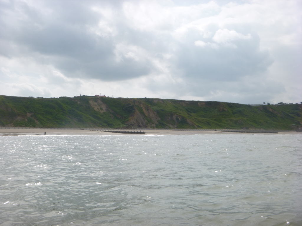
Lunchtime Starts

Day 29 – Happisburgh to Weyborne - 18th June – 17.8 nm

The wind has shifted in the night and is now roaring across the cliff-top campsite. The boats are rattling and creaking disturbingly on the van roof. This means an early rise, as I reluctantly emerge from the warmth of my maggot, to turn the van back into wind - before the boats head down the coast on their own. Yeah whatever...

But I figure that this means I won't need to be putting on damp paddling kit for a few more hours, a quick glimpse of endless-white over the cliff edge confirms things; it's blessedly back to my maggot for now.

The tide runs from lunchtime, but the forecast only gives a drop in the wind mid-afternoon, with a little swell due in later. We are determined to salvage some miles from the day and so head down to the beach. It's another hurry-up-and-wait day, as we sit in the car park, ready for any changes in the wind.

The lunchtime starts are surprisingly unpopular within Team Fatboy – the late start makes it difficult for Team Manager to get a run/walk/cycle/'swim' out of the day, when combined with the daily drive and admin.
While I don't miss the early starts, the late finishes make post paddle admin, feeding and planning rushed, while kit drying is also difficult late in the day. But that's the way it is, I'm no King Canute.

While we wander around, watching the water, it becomes clear just how significant the erosion problem is here. The soft cliffs are swifty moving inland, witnessed by the amputated roads and skeletal pipes protruding from the muddy cliff faces. The beach is littered with disturbingly recent remnants of unfortunate houses, claimed by the coffee coloured waters below. It is a sad sight.


In-vain sea defences are strung along the beaches, making access difficult. From a paddling point of view, these defences make the sandy coastline surprisingly exposed and limited for many miles. At high-water there can be no get-out options for unexpectedly long distances. Damaged, and paradoxically eroded defences can make the game of landing-roulette a little too frequent.


But life goes on; the wind does drop and soon I'm on the water.
Nothing dramatic happens - I paddle, the boat goes forward, that's it.

The late start means an inevitably early disagreement with the tide. Cromer sulkily slips by as the wind falls completely away and conditions go oily. I know what this means, the tide is going to change; and I suspect, that in turn, means that the wind is going to strengthen once again.

I paddle through slack as I pass West Runton (where in 2012 the Post Office kindly held a re-supply parcel for me - it's those little things in life...) But by Sherringham the tide is against me and soon the wind strengthens, right on the nose.

Before long I'm scratching along at 3 kts or so and decide it's time to call it a day at Weyborne. I pick Norfolk's only shingle beach, a refreshingly grey hue this time though. The wind, flow, swell and a horde of angling types conspire to make for a tricky, pearl-dive of a landing, through a rather nasty dump. Team Manager gets wet feet as she has to grab the bow, to help stop me from sliding back down the slope, into the nasty bit.

While we carry the boat up the sliding shingle, she soggily apologises for the lengthy walk to the team van. After that landing I really don't give a monkies how far it is. I'm just happy to be off.


Boring?

Day 28 – Lowestoft to Happisburgh - 17th June – 22.7 nm


Team Manager decides to give Great Yarmouth a miss, she has had her fill of British seaside resorts for now I think. Instead she excitedly decides to head up the coast to visit California, I have a feeling that it may not quite live up to expectations.

It's an easy lunchtime start at Lowestoft and I head north once again, but something isn't quite right, the tide is flowing much faster than I expect. Something is amiss with the tidal planning, I make good speed but I have a nagging feeling that it may be a shorter day than hoped for. Bum.

The Norfolk coast is quite pleasant, the tide (other than the timing!) is straightforward and there is a welcome dearth of challenging headlands or tide races. With a bit of easy weather it is all pretty straightforward, a sort of sea kayaking-for-dummies stretch of coastline – that suits this dummy quite nicely.


Great Yarmouth soon slides by, it looks a little more industrial and a little less touristy than I remember. But after that there is nothing much to get too excited about, the low-lying sand and mud cliffs are not unpleasant but not dramatic either. Fine by me, a little drama-free paddling time would not go amiss.

In an uncharacteristically romantic moment I decide to paddle in to spend lunch with the Team Manager on the sandy beach at Winterton. Though of course I pay for this moment of rash decadence, as I have to return to the beach to free the single piece of beach-borne gravel from my jammed rudder.


I do run out of tide, as anticipated, and land early, and slightly disappointedly, at Happisburgh. The cliff-top campsite is a beautiful setting though; while the nearby pub is just one of many that easily blends into a soon-forgotten list of mediocre food and beer.

After spending a sweaty day in The Van, Team Manager decides to go for a 'swim' under grey skies – she gets nothing more than her knees wet and returns - the water is cold (surely not...) and the seals are too close apparently. It took her longer to put her cossie on.

A day that was memorable just for the sheer fact that nothing really memorable happened.


Lowestoft Illuminations

Day 27 – Shingle Street to Lowestoft – 16th June – 31.9 nm

Yeehaa! A lie-in at last! On the ebb brings a welcome late start, we relish sleeping bag warmth until a luxurious 9 o’clock (a.m. that is) shows on the clock. It is also going to be a pretty straightforward start to the day, for once. The wind has dropped, the sun is out and no real swell is forecast – game on.

 The campsite is very pleasant, the owner takes serious pride in her site, we are reluctant to leave; unfortunately the same can't be said of the nearby pub. Hey ho.

Shingle Street is much more pleasant this morning, though still a touch too much shingle for my liking - I think I have an allergy forming.


Down the steep slope and away, perfect conditions to paddle along Orford Ness – nice. I am intrigued by the Ness and look forward to the next few miles. Yet more shingle though.

The tide works nicely and soon the concrete pagodas of the long-extinct nuclear weapon testing facility loom into view, lending a ghostly touch to the peace and quiet. Next comes the incongruous lighthouse, seemingly too close to the edge to me – one of the (very) few instances where I think a touch more shingle may be useful.


The pretty town of Aldeburgh slips by, followed soon by Thorpe Ness, and then the nuclear theme, continues with the pressurised water reactor at Sizewell.  The Weather Gods are obviously on their lunch-break, the sun shines and there is just a gentle breeze. It seems such a luxury to eat, drink and yes, of course, to have a pee, without any precarious swell-dodging spraydeck-rushing moments.

The low cliffs at Dunwich drift by, while Walberswick doesn't appear to be quite as humorous as its name. More low cliffs follow, until a rare bit of sand at Kessingland and then Lowestoft is next. I have been following the Lowestoft wind turbine for a while now; geography and tide dictate that I will complete the day just to the north of the town.


Of course, the day of a UK Circumnavigator isn’t that easy. The wind quickly strengthens as I close on the town and the rebound from the sea defences and the harbour wall put a slightly stressful mark to the end of the day. The Team Manager is also having a slightly rough time as she tries to meet up with me, in a not-so-shiny part of town. The moment is lifted though by a car load of rather bemused Chinese Tourists and a very pleasant chat with a gentleman walking his dog along the beach - it looks the sort of place that you need a dog in order to go walking along the beach. A big dog preferably. 


Later we reflect on the lack of spontaneity in modern British camping; 2 sites – 'no tourers', 3 sites – 'members only', 1 site – 'no access without a pre-booking'. Eventually we find a very pleasant site where we are allowed to choose our own pitch and are even trusted to drive there un-escorted. Big boy's stuff now.

Later a beer is opened, and while the sun goes down we watch another owl and then the onset of the Campsite Illuminations Competition (Suffolk Area) as the caravans light up in various extremes of multi-coloured glory.  Good ol’ Great Britain.


Anti-Clockwise Lessons

Day 26 – Frinton on Sea to Shingle Street – 15th June – 14.6 nm

One reason for paddling anti-clockwise this time around, was to compare and contrast the two opposing directions.  One major difference in 2015 was going to be paddling the majority of the route on the ebb, I knew this would change things a bit but I hadn't quite realised how significant this would be – today gave me a hint of what was to come.

It is a hurry-up-and-wait morning, part of another give-me-a-break day. The conditions are marginal with a stiff off-shore wind at Frinton, but I guess that north of the Naze it will be too much. So I faff and Team Manager writes her diary, while trying, not entirely successfully, to stay patient. But I know to trust my instincts, and I don’t feel ready to go. So I faff some more - Team Manager grows less patient. I stall with some zen-like prophecies of dropping winds at lunch time.


At lunch time the tide changes and the wind does too, conditions quickly settle, it feels right to go now. But I am caught out and have to hurriedly get ready - after sitting around all morning I still manage to be late.


After an easy launch, the pier comes and goes nicely, the Naze too and then it starts to get a little choppy with the wind rattling out of the river valleys – the Orwell and Stour. It is no surprise though and if it gets no worse I can handle this until I am across to Felixstowe. Knot-tying time once again.

But it does get worse; suddenly it all goes from choppy, through lumpy, into nasty and beyond. It probably only lasts a mile and a half, but jeez it really is quite unpleasant. Once I get across the Harwich channel things settle a little and I scratch, in a slightly dazed manner, along the coast - trying to avoid the wind and a bit of a swell from the north east.

I struggle against the wind and flow at the mouth of the River Deben, and make a complete cock-up of the line and have to sneak across a surfy, rudder-scrapingly shallow shingle bank to get back out. Eventually I've had enough, you can take your kayak and stick it.

I call it a day, just up the coast, at Shingle Street. It’s a very pretty place, if you have a thing for shingle, but I don’t, not any more.

The Team Manager’s diary sums it up – “John arrived exhausted and upset, he had an awful crossing to Felixstowe.” 


So what happened? Well I'm paddling on the ebb now, so all the rivers, bays, estuaries and harbours are emptying rather than filling. The extra flow coming out builds the conditions, significantly - especially if it is pushing against swell or wind. And of course this happens outside of the bay, harbour, estuary etc. – right where the UK Circumnavigator tends to route. On the flood this effect is not significant as any trouble is inside the feature, usually well away from the route – the paddler cruises across upstream of any trouble.

This effect was obvious on every major river crossing – Humber, Tees, Tyne, Tay and so on. The Tay was a memorable example; it turned gentle 2 ft swell conditions into an extensive spread of 6 ft breaking, with its own wind too – and that was 5 nm out from the mouth of the river. Similar effects were to be found at harbour mouths too, combined with a bit of swell and things could become quite unpleasant.  It was a phenomenon that was to be treated with respect.
   
Oh yes, one of the joys of going the wrong way around.


Thames Crossing

Day 25 – Broadstairs to Frinton on Sea – 14th June – 31.6 nm

Set out from Joss Bay (Broadstairs) into a gloomy morning. It had blown hard, with heavy rain, during the night – but things had settled now. The forecast, once again, was for the wind to pick up as the tide changed later. This made it a little difficult to dress for the conditions; I didn't want to sweat my way across nor to freeze my bits off for the last couple of hours. I also didn't want to make a tit of myself as I fell in, 7 miles off-shore, while pulling a cag over my head during the knackered stages – sweaty it would be I guess.


Reasonable progress was made initially, aiming off for the tide and following a route of buoys like a giant slalom through the sandbanks. As per 2012, it was an interesting opportunity to try out some good old compass nav, I was enjoying myself, though I'm convinced some of the buoys must have moved a bit. Or perhaps the chart was wrong?


Anyway, later as I closed on the Gunfleet Sand windfarm the forecast wind arrived, stiff, cold and northerly – it brought a chilly rain and lowering skies too. From there it was a tedious slog for the last couple of hours, lightened by the passing of a long-way-from-home tug from Holyhead. As I neared the coast the VHF came to life, it was clear that the Team Manager had managed to beat me across, bugger, 1-0 now - but all was not lost there was still the Wash to come! I headed in to a grateful landing on the gloomy beach at Frinton on Sea.

Dragging the boat up I smiled as I realised I had now completed the Thames Crossing in both directions.


South Coast Reflections

The South Coast came and went, there had been some interesting paddling, some pleasant and some less so. But when I thought about it all, I realised I wasn’t too upset to be heading north.

Landmarks: Land’s End, Lizard and Beachy Head had gone by relatively easily – less so for Portland Bill, Start Point and Dungeness. C’est la vie.

Weather: The south coast was hoped to give an easy early-stage lead-in with a hoped for combination of an easterly flood and westerly winds. This had manifested as winds from pretty much everywhere – the relentless easterlies of the south east corner were especially frustrating and unpleasant against the flow. Swell free days were few.

Mileage Downer: A 25 mile overall (including weather days) daily average would give a finish around the 75 day mark, 23 nm would give 80 days – the aim. By the time we reached North Foreland our average was a low-point of 20 nm and the projected finish was 92 days. It was depressing.

Van:  ‘Van-life’ was good; though a little slow to get a routine going initially (‘Where the 8888 is my 88888888 cag then? - Why can’t I ever find anything? – Well who put it there then?’) It was better than dragging a loaded boat around while looking for waterside spots to pitch a tent along the built-up coastline.

Wildlife:  In 2012 less wildlife was seen here compared to the rest of the country. 2015 didn’t seem any better, rather disappointing.

Coincidence: Weather bound in the same places and fighting the same stretches of coastline as 3 years earlier going in the opposite direction - coincidence or geography? A bit of both I guess, but even so it seemed slightly weird at times.


Disneyland: From the water the scenery had some very pleasant moments, but the Team Manager’s diary sometimes reflected a different perspective - “Some parts are certainly beautiful, some towns are lovely and some run-down. However nowhere is wild. Nature seems to be managed as a resource, a facility to make money or to entertain, organised as somewhere for the population to relax – nowhere is wild.”

Sitting Around

Day 24 – North Foreland – 13th June – 0 nm

I was glad to be heading north at last, to leave the South Coast behind – well, except we weren't.

 Today was supposed to be the crossing of the Thames Estuary, 26 nm of open water and technical nav; I was slightly nervous but looking forward to it.  I enjoyed my previous crossing here in 2012, it was a highlight of the trip, and so I was looking forward to seeing it all ‘in reverse’ this time. However, once again conditions were annoyingly ‘sort of, but not quite’.
   
The weather may have worked for a coastal ‘options’ day, but to paddle across 26 nm of shallow water, sandbanks and nav probably wasn't the best of ideas. It also boils down to more basic things than just the paddling perhaps, it would be a 6 hrs+ crossing and frankly for me that is too long to go without a pee - I could tie a knot in it I guess. Going on limited food for that length of time was not a brilliant option either.

It took time, and was frustrating, to make the no-go call, but I knew it was the right thing to do.

So once again we dodged the ‘youf’ and headed back to base. Pascale set out on a bike ride to Sandwich and Deal. Rather ironically she couldn't find an open bakery for a lunchtime butty there.

 I sat on the campsite - planning, snoozing, kit-checking and answering an eclectic mix of PSK emails: Taran Handling in New York, Boat choice in the Southern Hemisphere, a coaching booking for 18 months hence (I didn't even know what I was doing tomorrow!) and big rudder v little rudder.

Life goes on I guess.

Footnote:
During the day I calculated that with the current daily average, the projected finish was now  around 95 days. It made for a bit of a glum day. I didn't know at the time but the actual figure of  92 days was to be the highest figure for the whole trip.

Living The Dream – the Beachcomber and Split Shifts

Day 23 –St Mary’s Bay to North Foreland -12th June – 33.2 nm

07:10 on the water, heading out under leaden skies and through a slight chop, towards Folkestone. The early start meant I could sneak through the edge of the Hythe Range while the gunslingers were still cuddled up in beddy-boes.


By Folkestone the sun was out, the breeze had dropped, it was warm and things were positively enjoyable. Unfortunately my digestive system wanted to join the party and I had to scramble up the shingle in search of toilet facilities. On the beach I met a gentleman whose job was to clean the beach here. He did a good job it seemed to me. We got chatting and I learnt of the history of Folkestone, the beach and the landmarks.

I also learnt that, as part of a rejuvenation programme, the beach had been replenished with a good deal of material, going from a scruffy 6ft foreshore to a wide, sculpted oasis of smooth shingle. He also wistfully pointed out, that he now got the same number of hours (and wages) to clean the ‘new’ 100 yard wide beach as he did for the previous narrow strip – life’s a beach I suppose...

On the first UK trip I met and spoke with people daily. It was obvious you were doing something unusual when you hauled your little boat soggily up the beach. People were inquisitive, they wanted to know what was going on. It was always nice to chat, to have a little company and to hear local tales and stories. 

But in 2015 things were different, I was not alone this time, and we were staying in a van. I had gone from being an adventurer to a tourist. At times it seemed people only wanted to talk if they thought they could make money from us. This made my Folkestone chat all the more enjoyable; it’s the little things in life...

But miles had to be made, the sun was still out as I got back on, to head towards my second corner, this time at Dover. Here I played by the rules again, but this time the people were helpful. I called Dover Port Control on Ch 74 and they patiently guided me across the harbour entrances, to the slight consternation of one of the ferries, as he approached the easternmost entrance.


Running out of tide, I landed at St Margaret’s at Cliffe, only for another chat, this time with a fisherman who was hauling his boat up the shingle.
Team Manager arrived and we ate bacon and egg butties from the beach-side cafe, while we waited for the tide. Today was going to be our first split-shift of the trip.

A newly retired ex-Police Officer came to chat, he was initially interested in the van but grew increasingly interested in the trip - he had just started paddling. “Living the dream” he commented; I must admit that wasn't the first thought that wearily came to mind.


So much talk in one day! I couldn't remember being so popular, I must have forgotten to put on my well-polished, grumpy-old-git aura this morning.

It clouded over and as the beach emptied, I dodged a French thunderstorm to get back on.
It was dark and grey but oily smooth, as I happily headed north for the first time.

The tide was feeling sorry for me and I glided swiftly towards North Foreland, to finally call it a day at Joss Bay. Here we encountered the seemingly most dangerous part of the day, dodging the local ‘youf’ and a rocket-powered transit van. We ate the world’s worst (so far) fish and chips in Broadstairs,  before heading off to find a campsite, preferably one with razor wire.

Later we fell asleep to the sound of Ramsgate’s boy racers, who were obviously in serious all night training for the upcoming Big Engine-Little Willy Championships of Kent.

Good miles today - poor forecast tomorrow.


A Birthday Faff

Day 22 – Dungeness to St Mary’s Bay - 11th June – 6.7 nm

Another early start to catch the start of the tide, the wind had dropped a little but it was still a windy no-go. Back to the campsite for a snooze; except the man wanted to mow the grass, even the bit under the van it seemed. Eventually we took the hint and left.

The day sluggishly drifted by, I was tired, ratty and still a little shaken by the range day, and the chance of getting around on tonight’s tide hung like a shadow. Relaxation wasn't forthcoming.
We headed back in the afternoon; I sat and watched the water, intrigued by the large boil caused by the sub-surface outflow from the power station. I watched it wander and change with the tide – intriguing.

But things still didn't look right to me. No go.

It was time for a good hesitant faff, time to listen to the instincts. Things were not ready yet, but conditions were slowly changing I felt. At the same time the clock was ticking; Team Manager, try as she might, was getting a little impatient at my indecision, and day light was not going to last forever either. But still things didn't feel right – still no go to me. I had learnt to trust in my instincts, I couldn't say what time things would be good to go – I would just know when it was.

And then a route started to form on the corner, there was a gap. The wind was easing, and backing N a little. It was dropping to mid to high 20's now, except for the corner it didn't look too bad out there.

I watched. It felt right now, I suddenly felt good to go. I took a quick walk to memorise the line and then, let’s go, now - quick.


A nervous slide down the shingle, dodge the angler’s lines, looking for the markers in the waves, into the gap, nasty dump on the side, into the tide race, heading nervously out to keep the waves square on, the lifeboat station draws level, and then things start to ease – phew. Happy Birthday Fatboy.

I continued north with an eye on the breakers; it was busy along the coast as the kite-surfers were making the most of the sunshine and on-shore winds.  Suddenly they had all gone: Tea time? Beamed up by aliens? The lifeboat man had warned me that there wouldn't be much beach later in the tide, I realised they had got off before the sand to shingle ratios had dropped to potential embarrassing incident level.

Too late now, might as well go a little further. St Mary’s Bay was the destination; I looked for a gap in the nasty dump with no luck. Eventually it was a case of just get on with it you big girl. Helmet on, tensed for a soggy, shingly get-out, I surfed in to find the massive dump was... a foot high – much to the bemusement of Team Manager. Mummy’s Little Hero.

It was a long day to scrounge only 6 nm, but I was around Dungeness, and that would do for a 48th birthday present. 

You can only take so much shingle in one lifetime.


Stuck

Day 21 – Dungeness – 10th June – 0 nm

Despite the forecast we awoke early to see if there was a chance of getting around Dungeness, there wasn't.
It’s a frustrating headland, no towering mountain of imposing cliffs, no definite scary no-go appearance, just an innocent looking low shingle outcrop.


It is only 2 nm from the power station to the lifeboat station, but there is no beach between these two points, just steep shingle. I couldn't see a route through the nasty stuff around the corner and the waves at the lifeboat station were just vicious. The wind gauge was showing 30 mph+ more than it should.  If things didn't go as planned out there were no realistic options.

It was time for a snooze.


We returned late in the day to see if there was a chance of a sneak around, once again, there wasn't.