2 out of 3

Day 45 – Port Erroll – 4th July – 0 nm

The campsite was lashed by the rain and rattled by the wind all night long, but within the security of the van all was fine. I'm glad I didn't have to flap my way through through that lot in a tent.

The fog hasn't gone anywhere, the view extends no further than the hedge at the edge of the camp field. The forecast is for 20 mph wind and with a large swell, on the hilltop outside it’s breezy but not 20 mph. Today’s route involves get-out-free cliffs for the first hour or so – I fancy taking a look before I commit.

We get soaked as we fight our way down a soggy, overgrown track to the cliff edge, only to find there is not much to see – through the fog we can make out the water at the base of the cliffs but little more. There is a large swell running, the cliffs are buffered by a width of white foam that fades into the fog. But we can’t make out anything beyond this. We can hear more than we can see.

We drive further along the cliffs and go for another wander. On the way to the cliffs we pass a returning group of bemused French tourists who are trying to find a good viewpoint. Today? Try Machrihanish I reckon.

Once again there isn't much to see, but one thing is obvious the 20 mph wind just isn't there – it’s calm. Bugger.

Another faff as we head back down to the harbour at Port Erroll, here the swell is obvious as it climbs up the sandy beach.  Here we go again - it’s now crappy decision time.

I believe it’s not going to be nice along those cliffs with the swell, but I can’t say for sure, because we just can’t see it. It may be ok around the corner, or it may be nasty, who knows? I wish someone would make the decision for me...

We are 6 weeks in now and physically I feel pretty good - we need the miles, I want to be able to crack in the miles. Today is frustrating as there is no wind – without the swell it would be a fairly straightforward paddle.  But the combination of swell, fog and cliffs is too much perhaps? Drop any one and things could be on.

As we head to the reliability (and calories) of the supermarket cafe I suspect it’s going to be a paddle-free day, with a good serving of second-guessing and doubt...

Just for a change.


Apocalypse Then

Day 44 - -Stonehaven to Port Erroll – 3rd July – 31.8 nm

07:30 on the water again; it’s a bit of a drag struggling out of a warm maggot so early, but once the boat leaves the beach a slightly smug feeling develops as I get started before the world or wind-gods awake.

Out of Stonehaven paddling on an oily calm under clear skies, there’s a lazy swell but that’s all – a nice start to the day.


The tide is running and the low, green cliffs slide by peacefully – the map displays some intriguing location names: Tilly Tenant, Grim Brigs, Brown Jewel, Through Gang Point, Arnot Boo and the best of all – Blowup Nose. It’s a pleasant and uneventful paddle, and I'm happy about that.

I clear Girdle Ness on a food-break drift, but my laziness is spotted by Team Manager and I receive a quick ‘morale-boosting’ call to ‘help’ me on my way. Next I have to work my way through the fleet of moored platform support vessels. I'm slightly on edge as some seem to hold position without anchors – so there is little warning when they decide it’s time to suddenly head in to Aberdeen for a brew. The last time I crossed here I was impressed by, and eventually weary of, the number of helicopter movements. There was a constant thrumming beat in the air – Apocalypse Now. Today the skies are much quieter, just the odd cab heading east to make a black-gold shift change. The price of oil is low now – Apocalypse Then perhaps?


Back to reality: the sun is still out, but the tide is starting to fade now, it’s another split-shift day of course. Just ahead lies the Black Dog Range, it’s not a big one, only just over a mile wide but I can’t make out the buoys on the far side. In fact I can’t see anything on the far side; everything lies hidden beneath a great example of a North Sea Haar. The fog starts in a perfectly vertical grey wall, it creeps slowly and slightly ominously towards me. It reminds of the sort of film where nothing good comes of the variously hapless characters. 

I reckon if I can’t see the edge of the range then the chaps with guns can’t either – it’s nearly Friday lunchtime anyway, they’ll all have nobbed off home by now. I head in towards Balmedie, where the plan is to sit out the tide for a few hours in the country park.


I disappear into the chilly fog, it’s strangely choppy and breezy inside, outside it was a still calm – a sudden and slightly unnerving contrast. Balmedie lies behind a long featureless beach according to the map. Visibility is down to less than 100m now, if we don’t get this right I can see a comedy afternoon as Team Manager and Fatboy stumble around in the fog inadvertently avoiding each other for a few hours. ‘Excuse me. Have you seen a guy dragging a kayak on a trolley – a grumpy and soggy looking guy?’

 A quick call and the brief is for Team Manager to stand at the end of the stream, while my end of the bargain is just to get my act together and find it. I sneak through a premature sand bar of surf and then hit the beach just a few metres to the side of the stream (got to handrail you see?), at the feet of Team Manager – she’s well impressed! Thank-you Mr Garmin.

We haul the boat past the burnt-out shell of a Fiesta, a nice beach decoration, and then along a convoluted walkway to the van. We sit out the afternoon accompanied by the coming and going of a wide-ranging selection of society. Some of them are a little unnerving. I enjoy people watching now and then, but I’d rather be watching some of this lot through binoculars at least. Later on, entertainment is provided by Aberdeen’s Formula One Branch as they race around the car park. It's impressive how much effort they put into scaring grannies and trying to kill kiddies on bikes.

Eventually the tide has turned and we watch the country park flag stream as the wind increases. I head slowly down to the beach, if I move slowly enough it might all go away. I hope the wind will shift the fog, but no such look, I head out into the unknown.


There’s a bit more swell now and the S wind makes a splashy chop. It’s rather unnerving to have no visual cues at all, even with the compass and GPS I find it a struggle to maintain my heading as I zig-zag my way northward.

With the sandy beach somewhere on my left the conditions are not a problem. After Newburgh the map shows a low rocky coastline and things chop up a little, but it’s ok.  A little later things start to become more confused, the map shows cliffs along the edge and I guess the swell is rebounding out. The foggy zig-zags are becoming more pronounced now, as the boat sneakily turns to match the sea. It starts to rain, a miserable cold drizzle.

By the time I get to the appropriately named The Skares I’ve had enough. I drift blindly into the confused waters off the end, the swell is starting to break now and then and I'm not getting much warning of it coming through the fog. I turn into Cruden Bay and immediately things settle, I consider carrying-on but as I look over to the side a chunky one looms out of the fog and I quickly switch back to Wuss-Mode - harbour here we come! Once again, Mr Garmin helps me out as he takes me to the Port Erroll harbour entrance.

I'm glad to be off the water, the fog and drizzle doesn't really do a great deal to help the motivation. From the top of the sea wall I can’t see much, but the waves I can see don’t look that big, but then I'm looking at a sandy beach now I 'spose. Oh well, I'm off now anyway.

 A little drier and warmer we head up to the pub to see if we can get some food. The young staff are surprisingly rude and I distinctly get the feeling that my not-from-here accent sealed the deal when it came to not serving us. We leave empty handed.

I'm on a bit of a healthy-eating drive at the mo anyway, so we head into a rather bleak Peterhead and buy a healthy and nutritious takeaway from a very friendly Turkish gentleman - "Anything on it Sir?" - "yes, more calories please..."
We retire to the wet and windy hilltop campsite, still enveloped in the fog.

Oh the glamour.


Warp Drive / Just Another Day

Day 43 – Arbroath to Stonehaven – 2nd July – 28.6 nm

The campsite man is pleasant and we have a nice chat. He corrects me though when I reply that I am paddling around the UK – I am paddling around Scotland, the rest doesn't matter he tells me – there’s no smile in his eyes, he’s serious - unusual.

It’s not FFS early, but it’s early enough. We return to Victoria Park, it’s peaceful and very pleasant as an early morning mist slowly burns away.

I head up onto the cliff-tops once again and things look much better, there’s still a tell-tale band of white foam along the base of the cliffs, but it shouldn't be a problem – the sun is out after all.


I can’t be bothered to drive back to the beach at the south end of town so we take our lives in our hands and carry the boat gingerly across the slippery rock ledges for a sneaky launch through a narrow gulley. I paddled by here yesterday, before I turned back, so I guess it still counts? Team Manager frowns unhelpfully.

There is still a swell running but there is no wind. It takes a bit of fortuitous timing to leave the gulley safely, but I'm soon out into deep water and happy to be paddling once again, under sunny skies - 07:45 OTW.

The cliffs drop to the rear, leaving Dickmont’s Den and The Deil’s Heid behind is probably not a bad thing I reflect. The swell makes enough rebound to keep me awake and I am happy to accept that I made the correct decision when I turned back yesterday. Conditions are much better today but it’s still enough to keep me a distance offshore, yesterday could have ended in tears I reckon.


Lunan Bay is a sandy oasis lying rebelliously in the rocky coastline, it looks like a pleasant spot but it’s not on the destination list today – hopefully.

I close on the shiny lighthouse at Scurdie Ness, by Montrose, and once again I spot my mad female stalker waving furiously out to sea, that lass is going to get locked up one of these days...
Montrose Bay resorts to bit of one-upmanship as it extends its quiet sandy beach for twice the distance of Lunan Bay, before the low rocky coastline begins again.


We are on split-shifts once again; this morning’s landing options are probably going to be a selection from Johnshaven, Gourdon or preferably Inverbervie. The tide turns on time, but a little quicker than I expect and as the swell lifts I find myself in a bit of a scruffy tide race off the rocky ledges at Johnshaven. The map shows a rather narrow gap for an entrance to JH, this is confirmed by the Team Manager who stops for a look on her way by. The swell isn't big but it’s enough to mean that you don’t want to get too close to those ledges. Landing through the gap doesn't sound like the cleverest option.

I'm pushing against a knot of tide now and the swell is breaking along the ledges in a sort of  ‘you ain't landing here’ reminder. Team Manager calls to say that the beach at Inverbervie is dumping but has a gap - if I'm quick. Oh yeah, I’ll just pop it into Warp Drive then.

Before I can get there I receive another call, the beach has just closed out – ‘You Snooze - You Lose’.

Well, it sounds like a harbour landing in Gourdon then. There is an impressive break on a reef just outside the harbour, I do a Major Tom, skirt the reef (by miles) and then follow a small, blue crab boat in. The reef was one of those micky-taking, wind-up ones – you get all worked–up and all dressed-up, to then have a perfectly flat paddle in of course.


The sun is out and we sit on the edge of the harbour, watching Gourdon life go by in a flurry of fish-processing and loud cars. At the same time there is something of a paradoxically sleepy air about the place. After a morning on the water the ‘Award-winning’ Fish and Chip shop (sorry, restaurant) sounds the perfect lunchtime option.  I can’t see that they would have won any awards where I come from...

Team Manager heads off on her bike for a ride in the sunshine while I take a wander around Gourdon and do the scruffy traveller impression as I clutter up the place with drying kit. 
Eventually our harbour-side idyll has to be broken by a return to the water – Stonehaven next. On the way out of the harbour I overhear a couple of tomb-stoning lads discussing the fun that would be had if they grab and capsize me as I pass. They run down the wall and jump, but forewarned is forearmed, a hard-right rudder and a couple of quick strokes and I’m soon beyond swimming reach – up yours ugly. I don’t feel as guilty now about washing out my pee bottle in the harbour.


The tide runs well now and I'm ticking along nicely at six knots. As the sun disappears, it grows a little chilly and with the grey skies things suddenly seem less fun.
As I watch the rocky reefs slowly morph into low cliffs, the swell now starts to rebound. The conditions aren’t big but they become quite confused. I can’t see a pattern to the chop at all, the swell seems to constantly vary in size and frequency, and it comes from all sorts of directions. The boat wallows and slides around tediously.  Eventually things are big enough to put a kaibosh on admin breaks and so I head in to Stonehaven to eat and to consider my short term future. I watch a sea kayak / lifeboat exercise (I think) as I eat.

I was hoping for a Newtonhill finish today, but after a few minutes of luxury in the still water of the outer harbour and a wuss-call with Team Manager I decide to call it a day.

Just another day.

Stupid Enough

Day 42 – Arbroath – 1st July – 5.1 nm

Last night was a late finish, it was nearly 10:30 as I got off the water. The day following a late finish is never a good one, motivation is lacking and thinking is clouded.

Van-Life is strained in this early morning, the split-shifts mean that the days are long not just on the water but for the Team Manager too - long days of driving, admin and wasting time. It’s stressful from the viewpoints of both on and off the water. I get the impression that Team Manager would rather be somewhere else at the moment – it’s crossed my mind a couple of times recently too.

We arrive back on the prom at Arbroath, there’s a bit of a swell running but it doesn't look too bad. The wind is ok. I take a quick jog up onto the cliffs to take a look at conditions around the corner, it doesn't look brilliant it must be said; the swell is running from the E/NE and is much more pronounced along the cliffs. Something nags, the instincts aren't happy, but I'm tired and I'm not listening.

The sun is out and I get another impression, this time that I should be getting on with things, my sleepy-start-faff doesn't help matters. As I put things together a man appears and starts to chat. I'm not very sociable, I don’t need any distractions at the moment.

He’s a paddler and is interested in what we are up to – Busted 3. More vague answers once again. He asks about the Taran, mentions a past in Wildwater Racing, of the Coastguard volunteers watching us land last night and he tells me of what to expect around the corner. I mention that I'm not convinced of the conditions and the tide but he thinks all will be ok along the cliffs. I break the 'local knowledge rule' and listen, it’s enough to clinch the deal.

I get on and paddle across the town, the swell is quite chunky off the harbour mouth but I sneak through the gaps in the sunshine.

Along the cliffs things are confused and bigger than I expected.  The tide is against me too, at this rate it will be 1 ½ hours before I get to the end of the cliffs. I am not happy out here, I'm on the edge now. 

No, it’s not going to happen, it’s too far - I turn and head back.

It’s lumpy once again as the rebound comes out from the harbour walls to meet me, this time I cross town 2 kts faster. I make a hurried call to the Team Manager to break the news before she heads off along the coast. As I get to the south end of town and head in to the beach things settle and I have an embarrassingly easy landing – oh great, that’s going to make me look a real hero now - wuss-ville.

Have I made the right call? Am I actually just a big-wuss? As the boat rocks on the edge of the sand, I have a think. I wasn't happy, I thought it was getting too dodgy for the distance along the cliffs - that’s a good enough reason to turn back – listen to the instincts. They are there for a reason.

We quietly head up to the cliffs, I don’t say anything, I want Team Manager to to give me her opinion. We look over the edge and she tells me it looks pretty nasty. That will do, what I needed to hear.

We sit around hoping for better conditions later in the day, but it doesn't happen. The Boss takes a another walk along the cliffs as I snooze in the comfort of the van – she returns in a soggily hurried fashion as a thunderstorm hits. 

I check the tide figures in the Almanac and on the charts, today the tide was running against before the figures from both sources – more notes are appended.


We watch life go by for a while in the glistening Victoria Park, there are worse places to be. The day ends as we head back to the campsite to launder a bio-hazard bag of canoe kit, and to get some sleep - while we hope for better for tomorrow.

I am annoyed at today, I made the wrong decision.
I let little things distract me, to pressure me, and to cloud my judgement. I am happy that I made the right call to turn around, to have the balls to make that call. But I made the wrong decision to go in the first place. Again, clever enough to get out of trouble, but stupid enough to get there in the first place.


The Sting in the Tay - Seal

Day 41 – Dunbar to Arbroath – 30th June – 34.6 nm

Yesterday afternoon we took time out to visit Floors Castle near Kelso. Dad and M drove up to meet us and deliver a parcel of bits and pieces that we couldn't get hold of whilst ‘on the road’.  It was nice to be out of the trip world for a few hours, as we drank tea, ate cake and chatted of non-canoeing matters. But thoughts of tides, plans, weather and dodgy days skulked not far away in the background. Soon we had to return to the campsite, to get on with the job once again.

It’s an 18 nm crossing to Fife Ness but the wind doesn't want to play the game; once again it’s blowing strong – not so strong to rule out the day instantly and completely, but at the same time it’s strong enough to put valid doubts into mind.

I don’t like these days, the decision making buck stops with me of course and I feel the pressure grow – each day I wonder if I’ll get it wrong, in a nasty way. You are aware that you are tired and keen to progress, there is pressure – real and imagined – just how good is that decision making? As the trip progresses I find these days are wearing me down.

Paradoxically the sunny morning doesn't help, in the bay below it is breezy but under blue skies and the warmth it feels refreshing and looks appealing. But... the decision has to be made for the conditions 18 nm and 4 hours away, conditions that cannot be seen. The little machine shows the wind bouncing between 20 and 30+ mph - here.

If in doubt - faff.

We sit around; kit dries nicely in the sunny breeze (clouds and silver linings etc.) and the plan is re-jigged as the hours tick by.

Eventually the wind eases enough, the faff is over and the boat is hauled back through the jungle to the water’s edge on Magnolia Sands.  Good trolley that...


The breeze quickly pushes me out into the Firth, the wind delay means that the tide plan has all gone to bollocks now and it’s a big ferry glide from the start. But if I'm lucky this might work to my favour later I hope.

It’s getting a little choppy and I'm just wondering if admin stops are going to be feasible as I sneak into the shelter behind a conveniently anchored tanker. As I emerge from behind the tanker the conditions have surprisingly eased. Ours not to reason why and all that, this will do.
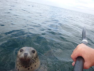
I continue across to the Isle of May where a brief pee break is interrupted by a curious seal – can a man not get a minutes peace, I ask you?


The tide is indeed working in my favour now and I make good progress across the increasingly smooth waters towards Fife Ness. I arrive in the bay to meet the Team Manager. We sit on the beach and she tells me of the pod of Dolphins she watched, as they frolicked just off the shore before I arrived – nature is putting on a bit of a show for us today it seems. Smiles all around.

I snooze on the edge of the sand under suspicious glares from the golf club behind. Soon it’s time to go again, it will be a late finish today, but it’s flat calm out there now – a 10 mph max following breeze and only a gentle, slight swell – almost perfect. Arbroath here we come!
I forget to start the GPS as I set out again, there’s the first mile missing from the diary then. There’s nothing to see out here, its grey with a little haze. Hills loom in the distance but they can’t be made out with any definition.


Then the wind suddenly changes, it goes through 180 degrees instantly and goes to high teens mph. This last for a matter of minutes and then just as suddenly it’s a following 10 mph again. The boat speed drops too. This happens again, and then again – strange. I realise that each time the wind changes the flow goes against me too, and this is becoming more frequent as I move across the bay.

I figure it must be some sort of gusts working their way down the Tay valley from the distant hills, linked with the exiting flow from the river – we are on the ebb now. Just as I'm reflecting on the previous lessons of paddling on the ebb against swell I realise things are changing. The small swell isn’t any more. Things change disarmingly quickly, the swell soon is above head height and breaking - they roll in long, ominously silent bands, all around. I'm nearly 5 nm from the mouth of the Tay, the swell was virtually insignificant and the wind similar – surely this cannot be the effect of the river emptying out here? Whatever - the reasoning can wait ‘til later.

7 hours on the go now, tired of course, and there isn’t a way around this lot by the look of things. It gets too steep for me, and I have to start running diagonally to lengthen the wavelength a little. It’s not really where I want to be heading but at the moment let’s just go somewhere a little flatter and sort out the final destination later.
Lights start to switch on along the coast in the distance, the impending arrival of dusk doesn't really lighten my outlook greatly as I hang in amongst the rollers – not a happy bunny.
But eventually I work my way through it all and things settle a little. The tide starts to go against me now – whatever... at least that will settle things further.
It is a late finish as Team Manager guides me in to the landing spot using a torch. I'm knackered and my eyes are just starting to retreat back from their stalks brought on by the Tay.

So what happened?
Well... looking at the chart later you can see that the there is an area of shallow water off the mouth of the Tay, no surprise there. But I didn't think it was particular shallow when I did my plan - 5m or more generally. What is probably more significant is the sudden change in depth. From 13-16m to 5m – quickly and right under my track, this could stack the SE swell. The swell at Fife Ness was 0-2ft, 2-4 ft further out in the bay – but always slow and lazy, there was no chop. This was all barely noticeable further out, but at the edge of the shallows the water depth quickly decreased by 2/3rds. Work this sudden depth change against the water ebbing from the Tay estuary and to some extent I guess, the katabatic wind, and it changed fairly flat conditions to unpleasant in a very short time.

I think the sudden wind and flow changes earlier on were large eddies or surges running along the edge of the main flow out of the Tay. I know that other tidal rivers and straits have regular flow surges within them, something like these perhaps? During the trip we were definitely starting to see a link forming between wind and flow changing together.

So what did I learn?
 The effect of the ebbing flow from rivers etc can stretch much further out than I gave it credit for – nearly 5 nm in this case for example. There had been hints of this earlier in the trip, but today brought things home – for the remainder of the trip it would get much more respect.

Pay attention to detail – see what is actually out there, in the plan, in the forecast and on the water – not what you want to be there. An old lesson, re-learnt once again.

Don’t get complacent. Another old lesson. Later in the trip, I learnt to assume that there would be a sting in the tail each day, and it would always be in the tail...


Back In Black

Day 40 – Berwick-Upon-Tweed to Dunbar – 29th June – 23.4 nm

Yesterday we had to decide whether to drive across to Glasgow with our tickets for the AC/DC concert, or take the good weather around St. Abb’s today.


Day’s are precious and the three fours and a zero on the alarm clock this morning (not necessarily in that order) confirmed yet another sacrifice on the altar of canoeing. Rock 'n' roll damnation.

Out of Berwick at 06:30 – sleepily. I paddle under a high grey sky and flat calm conditions - that will do fine. The plan is for the neap tide to take me to St.Abb’s and then just to slog steadily against things from there until either I've had enough, or Aberdeen – whichever comes first. I don’t really expect to hear the sound of helicopters at the end of the day though.


Nothing eventful happens until Eyemouth, where suddenly, a whole lot more of nothing happens.
I ease by a line of fishing boats strung along the eddyline and continue towards the cliffs of St. Abb’s Head. Last time I paddled this stretch, I cursed my way to Berwick in a stiff offshore wind, with a broken rudder cable and an intimidating swell.


Today is blissful by comparison. There is a bit of a breeze blowing over the tops, but that’s all. I avoid it by sneaking along the base of the cliffs anyway. The trade off is the all-pervading smell of pungent guano, but that's a fair trade I think.


Telegraph Hill goes by and I head towards Torness Power Station at Thortonloch. You’ve got to admit that the UK Circumnavigation is a great way to see all of the UK’s Nuclear Power Stations if nothing else.

It becomes a bit of a slog as the breeze is funnelled down from the hills and the out flow from the power plant slows things by a surprising amount too. But I'm in no great hurry, it’s not even lunch time and I won’t be going much further than the few more miles to Dunbar today anyway. Geography rules.


I sneak past the impressive array of Dolos units, energy dissipating sentries on the power station breakwater. They are individually numbered, and as I head along the breakwater I am intrigued as the numbers steadily drop.  I look on in excited anticipation, will I see No.1?  No.

I round the lighthouse on the low headland at Barns Ness and head into the pretty sounding White Sands. It’s more of a Scruffy Magnolia Sands really, but it will do. Dunbar can wait for another day, it’s time to put my feet up, after all I've been on my backside all morning.


The Taran is wrestled through a veritable jungle and then we dry kit in the breeze while we have a leisurely picnic lunch.  Later we head up the road to the campsite. I'm 860 nm in now, but we are once again guided to our campsite pitch –‘ just in case we struggle with the map’. Yeah, whatever...