Morecambe Bay Poo Sticks

Day 73 – Roa Island to Bispham – 1st Aug – 16.2 nm


Morecambe Bay is a fascinating place. It is an extensive area of drying mudflats and sands, split between Cumbria and Lancashire. The Bay has often been linked with tragedy; casualties and misfortune make up a good part of its history. The expanse of flat sands lure the unwary; the area is scattered liberally with quicksand and hidden channels, while the tide comes in at running pace in many places. Tidal bores run up three of the rivers that feed the bay. It is not often a forgiving place.

I played on the beaches there as a child, and later other adventures oft took me back to the Bay, runs from one side to the other and many bores were surfed. But until today I've never paddled across. It’s about time.

Last night’s campsite was another fun place to be. We watched as the feral kids tried to kick the fire alarms off the wall. Once they grew bored of that they moved to less energetic targets, working their destructive way along the bike rack. In the snooker room the dad’s drew the blinds when they saw what was happening outside the window. The wind blew all night, shaking the van.

We know there is no hurry to get to the beach, but then the campsite isn't the most fun place to be, so up and away to take a look over the back of Walney Island.  We are met by a wet and windy, white-capped vista.

We head down to Roa Island anyway, where it is blowing a hooley. It’s hard to judge the conditions out in the Bay, open water is 2 or 3 miles away. The binoculars tell a tale but can only help up to a point. But I can see a distant buoy rolling with the waves; I get the idea, no paddling for a while.

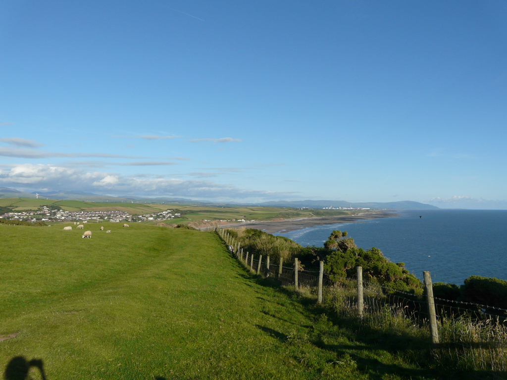
We take a walk out onto Foulney Island, marvelling at the countless Eider Ducks taking a break there. It is a pretty spot, with beautiful views out to the Lancashire Fells in the distance, familiar friends on my home ground.


But once again we are corralled by rope fences and endless forbidding signs. Our presence here is suffered obviously. I find it rather arrogant that some think the birds cannot tolerate any other wildlife passing peacefully by. Nature is far more resilient than so many give it credit for, but obviously only they are gifted enough to save the wildlife! A pity some of the sign making effort couldn't have gone into removing the plastic litter covering the place perhaps?

Rant over we head back, the tide is quickly coming in and as we near the van the track is swiftly becoming a causeway. I like to watch the water move and we sit and watch as it starts to flow over the stone bank, I am intrigued by the mechanics of one side being higher than the other.

As the salt marsh starts to cover we find the car park is becoming populated by kite and windsurfers. The dynamic is interesting to watch: there is a hierarchy and the top boy swaggers around, living up to the image, drinking in the adoration and sycophancy. That is until The Visitor rolls up, he pulls out his kit and quietly takes centre stage. The Alpha Male has just been out Alpha’d. David Attenborough could do a programme on this one.

It’s interesting to watch the folks skimming at high speed across water, only inches deep, skilful and speedy. But we get the feeling we are taking up valuable car parking space and take our leave.

A quick trip to the end of Roa helps no more to assess the conditions in the Bay and we retire a little further up the coast to take in the view and snooze in a peaceful picnic site on the edge of the Bay.

Eventually a no/go decision has to be taken; soon it will be too late to get across before nightfall. We head back once again to Roa. Thankfully the indecision is accompanied by a decrease in windspeed. Game on, let’s go.

Conveniently the long wait for the wind links quite well with the tide. There should still be flow down the channel and going across the Flats shouldn't be too bad, I’m hoping the fading of the ebb should settle the conditions out there a little. Further out, the Lune Deep runs out for about 9 out of 12 hrs I think, so that may be a little lumpy against the wind. And then I guess I’ll run out of tide somewhere as I close on Rossall, on the other side. But you can’t have everything, let’s get on with it.


It’s a splashy headwind out and down the ebbing channel. For 4 nm I have to be patient, ticking off the buoys, cut across too early and it may be impatient payback time as I get caught in the shallows. The last buoy goes by and eventually I can hang a loiue and point towards Blackpool Tower. The Flats go by with no hassle but then as I cross Lune Deep things chunk up quite a bit. It’s half an hour or so to get across that and I'm fairly glad when things start to settle. I'm expecting the tide to turn soon so I head in towards the coastline at Rossall, the venue for my first ‘surf’ outing.

A mile out the tide does indeed change, an increase in the wind accompanies the change. I find myself hanging outside the break, in the coffee coloured water. It’s not the most enticing stretch of coastal paddling anyway, but a number of years ago I stopped paddling here as I came across so many, to put it bluntly, turds floating in the water. I know the Utility company has been putting in some work in recent years and I am hoping to see an improvement. Not a major one it seems, Christopher Robin could have played poo sticks all day long here. I paddle along the choppy coast, marvelling on the diet of the locals that ensures their little mementoes can survive intact for so long in the surf.

Eventually the cold, wind and onset of darkness finish me off. I slide onto the sand at Bispham and trolley the boat up through the extent of concrete sea defences. As I reach the top, gasping for breath, I am very suddenly face to face with a very large and loud young guy, all muscles and so on. He is big, loud, in my face and accompanied by a carer.

I am a little taken aback, I'm only seconds off the water and not yet quite ready for Blackpool. But soon it dawns that he is a nice guy, he's just so curious about this idiot landing on the windswept beach in a pink canoe. He has so many questions - there is no edge, no agenda, nothing to prove, no pride or ego, just unbridled curiosity – all in a rather loud sort of way.

We speak for a while, until eventually the lady alongside drags him away without saying a word. He wishes me luck and waves as he goes. I reflect that I am lucky to be doing something that not everyone can have the opportunity to do. I hope he is doing well wherever he is now.

Seconds later I am standing in a crowd, holding a 5.5m of pink canoe on a trolley, waiting for the lights to change to cross the tram lines and promenade road. Blackpool Tower is all lit up just down the road.

It has been a day of contrasts.


Windy Walney

Day 72 –Stubb Place to Roa Island– 31st July – 18.4 nm


Not wanting to sound repetitive but it is another early start. It’s less of Team Fatboy nowadays and more of Team Knackered; enthusiasm is a vaguely remembered concept.

The S wind is due to pick up, and to do so early, it’s going to be a day of slog by the look of things. Yesterday’s sunshine is long gone.

The early stretches of coastline are flat shingle and sand - no cliffs, headlands or tide races. It’s going to be hard work but bang-out landings are possible for virtually the whole length. The down side is that there is pretty much no road access. If I have to get off then I'm going to be stuck with a long walk out, the trolley goes in the hatch.

Off the scruffy beach and into the high-teens headwind and against the flow - 3.5 kts stays stubbornly displayed on the GPS. It's not a brilliant start.


There's a 2-4ft chop so I stay out a little, keeping an eye out for the odd sneaky early-breaker. Once again the day’s tidal timing takes second place to dodging the incoming weather. This might make the route at Walney Island a tricky choice, but we’ll cross that bridge when we come to it.

As breakfast progresses along its way a toilet stop becomes needed by Silecroft. But as I close on the beach I can see the place is festooned with worm danglers, lines are everywhere. The mucky dumping surf adds to the complications. We’ll give it a miss.

By Haverigg Point things are a little more urgent and a trip into the dunes is required. The shallows make for an extensive and complicated picture of smallish surf and sandbanks, but things go ok and I thread my way in smoothly.

Here I'm 1.5 nm from the nearest road, sheltered from civilisation by the prison beyond the dunes. But just as the Gore-Tex is about to be dropped a gent suddenly appears out of nowhere, magically right on cue. Ahh, the old Mr-Ben’s-shopkeeper trick.

I'm freezing my bits off in winter kit, he’s wandering around in sandals and shorts. Nature is put on hold, and we have a chat. He’s an interesting guy who’s been brought up on the coastline. He doesn't give much away of his background but he knows the water well. He’s intrigued by the paddling trip, and we discuss the pro’s and cons of the imminent routing around or inside Walney Island. Eventually it’s time to take our leave, if I dally much longer I’ll run out of water on the inside route. The day goes on, but the people add colour to it.

I'm not going to get across Morecambe Bay today, so Roa Island is the final destination. The outside of Walney means an easier tidal route, but I worry that the flat shallow sands will make for extensive surf, and perhaps a bit of hassle around the bottom end. The wind is still picking up too. I go easy and opt for the inside route instead, anticipating a bit of eddy hopping to get me to Barrow.

The wind has increased now and it’s a splashy crossing of Duddon Sands. The flow coming out of the Scarth makes things a bit lumpy and I have to sneak around looking for a gap. Once I’m in the channel it dawns that it’s going to be a real effort to Barrow, the wind is blowing down the channel and the tide is running out quickly. Walney Meetings is a disappointing misnomer, it’s still running against as I paddle beyond and head under the Vickerstown Bridge. I slide onto the mud opposite the docks for a lunchtime breather. Off again and I finally get a little help from the tide as I move S of the docks. Yeah, Walney Meetings my arse, they need to redraw that chart for sure.

And from there on I keep myself to myself as I stay outside the marked channel and watch the impressive wind farm service vessels speeding effortlessly up the channel.

It’s still a slog against the wind to Roa. Unfortunately it doesn't bring back fond memories. Last time I was here 2 ‘we represent the RNLI...’ men gave me a bollocking for paddling in the dark, the coastguard joined the party and took offense too. But then I guess they know a lot about paddling. An unpleasant night.

This time I land quietly, and escape the place before someone decides to give me more shit about my canoeing.


We finish early, a welcome early finish. On paper it was only going to be a short day, but somehow it feels quite a bit longer.

I take the opportunity to catch up with the newspapers, a welcome diversion. There seems to be a big fuss brewing on childhood obesity. I think back to yesterday’s sunny but breezy landing at St Bees. There were a couple of fat kids wallowing around in the edge of the surf, clad only in swimming cossies. They seemed to be there almost to prove the point, but I reflect that every cloud has silver lining though. From the parent’ point of view they get more bang for the buck - the kids can play in the chilly water all day, and they float better to boot, so it’s safer.

So it’s not all bad. More chips please.


Bye, Bye Scotland

Day 71 –Balcarry Bay to Stubb Place– 30th July – 37 nm


It is a muted start to the day; Team Fatboy had a fitful night of sleep in the van overnight. Team Manager spent much of the night listening to the wind apparently, while yours truly was more concerned with the shenanigans of our psycho lorry driver.

But, the sun is out and Balcarry Bay makes for a pretty setting, all the more so because the tide is in and the gloopy mud is nicely covered.

The forecast is for light winds but a rather unruly W-NW is blowing out of the bay. Hmmm... a difference of opinion there it seems.

For once Team Manager is showing a little frustration -When is the wind going to end? When will we get a break? Fatboy is a little more sanguine for a change; it’s just another pissy paddling day, nothing special. Let’s go see what happens.

Out of the bay and point towards England. There were a few whitecaps forming inside the bay, it’s so different to the forecast that it’s just not possible to have any real confidence in a plan. It’s a sort of suck it and see, options day, with the added twist of a crossing too. There aren't really that many options for the first leg though – carry on or come back, that’s it really.


Once committed to the 13 nm crossing, Workington will be the first aim point, followed closely by Whitehaven – like peas in a pod...

After Whitehaven it’s all cliffs around St Bees Head, but then there will be a sandy coastline for the remainder of the day.

Meanwhile Team Manager has accepted a challenge to a race to the other side, with a brief detour to purchase our still-missing Cumbria/Lancashire maps along the way.

An hour and 5 nm out it’s a bit breezy, the earlier W wind was influenced by the high ground behind the bay. Out here it’s more from the NW. But the following sea is manageable and the Taran just wants to crack on. I guess I have to follow that lead.

It’s a clear day, the Robin Rigg wind farm lies just ahead, with the Cumbria Fells stretching into the distance behind. It’s a pleasant view.

The swooshing turbines soon fall behind and I throw the North Workington cardinal buoy into the plan for a bit of nav practice – it’s hard to miss it in the sunshine anyway. The conditions lift and fall as I make my way across, the channels and banks having opposing effects.

As I reach the buoy I turn S now towards Option 2 - Whitehaven. As I'm passing the buoy I get a quick call from Team manager. It’s a hurried conversation on my part but I hear enough to gather that she’s still in Carlisle – score one to the Fatboy, but then I didn't have to stop to buy maps - we don't do excuses...

Down near Whitehaven I decide to press on to St Bees, knowing in my heart of hearts that Whitehaven is the sensible option. But the miles just seem all too short there.

Of course the cliffs at St Bees Head make for large, lumpy and confused water, brief but demanding - oh why don’t you ever listen, Muppet?

But eventually we get around the corner and the Taran is threaded through the surf to land on the welcome sand at St Bees. The sun has brought the crowds out, the beach is busy. As I tidy the boat and unfold my trolley, I spend a time watching a double SOT in the far edge of the break trying to make headway against the wind. They don’t inspire confidence. I tune my psychic powers and urge them to turn in towards the beach and walk home. They don’t listen.

I find a quiet spot in the far corner of the car park and await International Rescue, while I sit in the breezy sunshine. I shake my head in amazement at a sudden group of boy racers roaring across the busy, child-laden, ice cream van containing car-park. It takes a while for it to dawn, but eventually I realise they are the Lifeboat crew responding to a shout. I ponder for a while on the dead kids v rescued seafarers equation.

Team Manager arrives to distract me and we sit around for a few hours as I wait for the tide. I have a chat with the owner of a new Tarantella and we discuss boats and things until I have to get on again, the pretty scenery of Sellafield awaits, tantalisingly down the coast.


I move out beyond the break and parallel the beach, the wind increases as I head S, but the sandy coastline makes for a straightforward paddle, as far as the Eskdale range at least. But I’m close enough in to see that there are no flags flying, and decide to land as soon as I can on the far edge of the range – at Stubb Place.


There’s not much to Stubb Place, just a couple of houses, a don’t-enjoy-yourself-here sign from the chaps with guns, a bit of shingle beach and plenty of cold wind.

So we soon get sorted and head up the road to a very pleasant farmyard campsite. It’s basic, but peaceful and friendly. We have a rushed boil-in-the-bag meal and as the wind finally drops we take a time-out to watch the bats hunting beneath the moon. Not a bad way to end the day, all too soon it’s time to head for the land of Nod.

Welcome to England by the way.


You can’t park that there mate...

Day 70 – Isle of Whithorn to Balcarry Bay – 29th July – 26.3nm


Another day, another crossing - this time it’s Wigtown Bay.

We've made the decision to go around rather than across the Irish Sea. There’s no time to think further on this call, it’s just time to get on with the job in hand - after all we've got an extra few miles to paddle now.

Today’s forecast is for a bit of sunshine, a few showers and plenty of stiff wind from the N-NW. The crossing is 9 nm and the map hints at high ground funnelling the wind down the bay. I get the feeling it’s going to rattle down here.

So, the plan is to head N, directly up into the bay, taking some shelter from the low cliffs. A few miles N will shorten the crossing distance, lessen the fetch and change the effective wind angle – so goes the theory anyway.

Once again it is an early start, on the water before 07:00. As we leave, the campsite reception still has a few hours of slumber ahead. Team Manager can’t be bothered to return later for the shower key deposit and so donates it to the Community Hall in Whithorn – assuming they dare to venture out there to reclaim it.


Out of Whithorn and point the bow N, it is breezy but the sun is out and blue skies always lift the day.  At Cruggleton Point a couple of girls are sat on a wall, taking in the early morning sunshine as they dangle their legs over the cliffs. I get a cheery wave and a shouted Hello.


Just short of the 5 nm point I reach Sliddery Point and decide things are FAB Virgil, I hang a reggie and point out into the bay now. The wind strengthens and the fetch increases as I move further out, but the mood is lightened by the sunshine and I'm happily making 5 kts. There’s a bit of rebound as I close on the headland, but I'm soon through the chop and slide into the calm of Brighouse Bay, taking a minute for a quick chat with a fisherman on the way.

The map shows a string of intriguing names here: Ringdoo Point, Meggerland, Three Brethren, Slack Heaugh, Sugarloaf and Fauldbog Bay - Manxman’s Rock hints at a pride-denting day out for someone with three legs.

The sun is just starting to lay a blanket of warmth across the sand and families are staking their beachbound claims for the day. We've to waste a few more hours here as we wait for the tide to go our way.

The sunshine brings the hordes and the small car park becomes increasingly fraught as people are singularly determined to reach the beach come what may. I take a break from the car based chaos and head up the hill to try to get a phone signal. The rest of the day involves a transit of the Kirkcudbright Range, I’d like to have an idea what the bomb-whangers have planned for the afternoon. But once again, Vodafone fails to live up to the mild expectation of a phone signal.

Eventually the beach starts to clear, closely followed by the cramped car-park. We take the cue and I wheel the Taran out over the rippled sand, in a quest for some water. We had the odd shower as we waited, but once again the sun is out now.


I paddle out of the bay and head E. A quick call is made to the Coastguard to ask if they know about the range activity. They don’t, but they make a call on my behalf and soon I get the good news that the range is not active for the day. It seems I won’t have to worry about the boys tossing Depleted Uranium over my head and out into the Solway.

As is the irony of these places, the range is a relatively unspoilt area and it is a pleasant paddle along this stretch. The wind drops away and I gaze across the oily calm of the Solway Firth to Cumbria in the distance. A call is made to Mission Control on the idea of making the crossing to the Lake District tonight; it looks so tempting in the still conditions. I am aching to go across, but it will be a late finish. I will probably get across before Team Manager and I don’t have a map for the area yet – somewhere along the way Cumbria got mislaid.

No, it's going to make a pleasant day too long and possibly fraught. So reluctantly I continue a little further and turn the corner at Balcarry Point. The sheltered bay is obviously a relaxed place water-wise, and I wade suckingly across the collected mud from the Solway to finish the day. It’s a pretty spot to end a pleasing paddling day.


We can’t find a campsite or accommodation. Eventually we plump for a lay-by with an impressive view out to the Cumbrian Hills. It will do.

Unfortunately a wagon driver decides it’s his place. He goes through an impressive and prolonged performance to encourage us to move on. We ignore him, even through the very public urination performance. It’s uncomfortable now, we don’t quite understand what his problem is. When we still won’t leave he comes over to tell us we should move on or he will awake us early in the morning.

It’s late, I've had a long day, in fact I've had a long few weeks. Fook off.

Another strange contrast from paddle world to real world.

There’s nowt as queer as folk...


The Long Way Around?

The Irish Sea

You've got to make the call fatboy, no one else can do it for you.
Across or around?
It was time to toss the coin.

I really wanted to finish in 80 days, for me that is a good marker for a serious attempt. The Isle of Man was only 15 nm away. With good conditions it would be a day to the island, a day to reach the south and then a day to cross to North Wales; 3 days from Scotland to the land of wind and rain. Even with a day or two for weather, that meant a 78 – 80 day finish was still on the cards. I really wanted that. Going around would take 7 or 8 days, maybe.

Things are never easy.

It was a 15 nm crossing to the IOM, but it was a 40 nm one to get off. The weather was not super helpful. I’d already taken a delaying detour to Whithorn to see how things were going to develop. The forecast ahead showed a 1 day window of good weather, but it was sandwiched between a day of coastal slog weather and then days of SW winds. A 1 day window was tight; if it wasn't good enough I was concerned that I could be stuck on the IOM waiting for the weather to make it off. That could take days, or weeks...


To add a little spice, not all the forecasts agreed of course.

I could go across to Ireland and run down the coast, to then make the Rosslare-St David’s crossing. But this would still leave a 40+ nm crossing at the end. I didn't have any maps for this stretch either. No, not really practical.


It was starting to look like going around the outside was the better alternative.

But it wasn't an easy one; there were plenty of crossings here too. It would start with an 18 nm crossing of Luce Bay, then a 10 nm of Wigtown Bay, followed by another - this time the Solway Firth. After a run down the Cumbria coastline there would be the fast flow of Morecambe Bay to contend with and then the inhospitable concrete coastline of Blackpool and Fleetwood to suffer. Following along would be the sandbanks of the Ribble Estuary and Crosby, before the busy shipping channel of the River Mersey. More shallows of the Dee Estuary would await, before finally taking a day to transit the North Wales coastline.


The more I thought about it, the more it appealed to get stranded on the Isle of Man.

So if going around the outside was not an easy alternative, why choose it in the first place? Well, it gave options. I could be stuck on the IOM waiting for the weather for who knows how long? If I went around the outside I may be able to progress a few more miles on poor weather days.

It was a tricky decision to make. By going around the outside I knew I had sealed the fate of the 80 day finish - it couldn't now be. But I couldn't be arsed getting stranded either, to sit around waiting for weather that may not come. Going around the outside it would be.

There was an upside to going around though. It would take me to places I had not paddled before. The ‘corner’ of the Solway Firth is often overlooked, that would be new to me. Morecambe Bay too. I had been brought up a few miles from the Lancashire coastline, on the edge of Morecambe Bay. On clear days I’d looked across to the sheds at Barrow, I’d now finally get to paddle across The Bay.
Cutting across to the IOM was a technical challenge, and it made sense timing wise for the UK Circumnavigator. But you missed out on a good chunk of the coastline - somehow it almost seemed like cheating a little.


When I turned eastwards I knew I would be second guessing this decision for a long time to come. But we had limited weather info, I was tired both physically and mentally, and there had been a few demanding days on the run up.

If I was in the same position again, I would have to go with the same decision.


Mull of Galloway

Day 69 – Port Logan to Isle of Whithorn – 28th July – 28.7 nm

Another late finish is followed, all too soon, by another early start. The forecast is not ideal for the Isle of Man crossing so I'm going to procrastinate a little longer, something I'm very good at – when I can be arsed that is.

So the plan means an early start to round the Mull of Galloway at slack, wait there for the tide and then cross Luce Bay to finish the day at Whithorn. This will give either a shorter crossing to the IOM tomorrow, or be the first leg of the Irish Sea the-long-way-around.

The rain finally stops as I head out of Port Logan, the wind is north-ish and there is no swell, life could be worse - an easy start to the day. I follow the cliffs south-ward, while the rather accommodating flow means I get a 6 kts+ escalator to the end.

As I cruise MOG-ward, I grow slightly more nervous with each paddle stroke. The conditions are good and I'm (fairly) confident in my plan and the timings, but still, it’s hard not to let reputation have an effect once again.

Before I go around the corner I take a brief visit into West Tarbert, just so I can see where the odd sneaky portage has taken place over the years.

I've been on the water for an hour and a half when I round the end, the plan works and all is calm. Once again reputation doesn't, well, live up to the reputation somehow.  Even so, it’s a bit of a relief as the Mull of Galloway is ticked off the list too. 

Life on the north side of cliffs is a little breezy, but no hassle and I have an easy landing at East Tarbert, to the intrigue of the curious cows. It’s 07:00 as the boat touches the beach.

The next 7 ½ hrs is divided between the Visitor Centre cafe and snoozing in the van.  The forecast is for 15 mph from the North but there is a difference of opinion between the forecasts, I have a feeling that something is brewing, it might be worth waiting a while to watch for any developments.


Eventually it’s time to get on again and I head out from East Tarbert, the cows come down to see me off. The N breeze is there as forecast, but there seems to be a hint of swell coming around the end now and heading eastwards. I hope the Mull will shelter me from the worst of it.

Of course, it doesn't.

7 nm out now and I reach the rather appropriately named Scares. The wind has strengthened from the north and the swell has grown as I move further from the shelter of the headland. There’s probably 60 degrees or so between the swell and the chop waves and it’s all getting to be a bit of a handful. I'm tired and not really enjoying life too much.

As the 3 hr mark ticks by I run past Burrow Head, with 7 kts showing on the GPS. Normally this would put a smile on my face but I'm concerned that there will be an eddy behind the headland; I'm worried how this will affect the swell.

I cross the eddy line and the speed swiftly drops down to 4 kts, and then below as I start to work against the flow.  The swell lifts as it encounters the flow too. I look over to the side to see if I can go around, but life doesn't look too pleasant out there either. Here at least the headland shelters me from the wind, there is no chop now. Even so it’s all rather intimidating; I sneak through the rocks to avoid the worst of the waves, timing the gaps to match the swell. It’s a long time coming but finally the bay at Whithorn provides welcome relief, the little harbour is a pleasing sight.

As is the way, the stress and challenge of the day is soon subsumed into the mediocrity of post paddle daily life. The day ends with another scruffy campsite (‘please boil the drinking water’), with strange looks from even stranger people.  We don’t belong.

It’s a little strange how quickly the challenge and sometimes stress of the paddling day quickly morphs back into the 'real' world. Some days it is almost jarring. It’s hard to get excited about anything, emotions flat-line. Life is just one big 'Whatever...'

The GPS shows 28nm, but somehow we don’t seem to have got very far today.

Whatever...


Hello People?..Mellow Out

Day 68 – Cairnryan to Port Logan – 27th July – 25 nm

The rain has stopped and the wind has moved southwards. Things are still soggy though, and as we try to leave our pitch I get the van stuck. The warden is unimpressed, he drags us out using his landrover but as we apologise he launches into a tirade of expletives. There’s no answer to that. I guess we won’t be here for a third night then?

As we drive away we joke that the big, grey elephant wanted to indulge in a bit of a mud bath before leaving.

Time is a bit tight with the mud-wrestling delay but we just make the launch time. The SE wind means the top end is thankfully fairly flat and things tick along quite pleasantly. By the time Portpatrick calls though I am working into a stiff headwind, it’s only really for the last few miles but somehow I just run out of steam and crawl into the shelter of Portpatrick harbour. A chilly rain meets me there.


Team Manager arrives too, after a trip into Stranraer to try to get hold of some Irish Sea Maps. Things don’t look too good for an Isle of Man crossing in the near future, a set of fallback maps for going around the outside might be a prudent purchase we reckon. TM says that eyes followed her around Stranraer, the red and white Taran on the roof seemed to draw attention.

I get a bit of a mummy-told-you-so lecture for not eating enough yesterday (don’t hear that often) and am now force fed like a French goose. 2 hrs later it’s time to waddle out into the miserable grey soggy stuff again. Go on, how about a bit of blue for a change?

The wind is blowing pretty strong from the S-SE. It’s going to be a bit of a slog down the coast. Port Logan is the next realistic get out option, and after that it is down to the end. But I'm not sure of how things will be down there so it will be decision time at Port Logan. 

As I leave, TM heads up to buy a newspaper but the welcome is unpleasant and unfriendly. Come on people, she's the nice one in the team. I really don’t know what is going on, but somehow we don’t seem to make a great impression at times.


Anyway, I'm on the water and away. It is a bit of a slog to Port Logan. Across Caringarroch Bay I get a bit of help from an eddy, but the wind blows down the gully fiercely. A mist drops in and the rain comes down so heavily that I can’t see the other end of the short bay. I carry on sneaking down, it’s windy and splashy but the direction means there is no real swell or rebound to worry about. It’s just a hood-up slog.

Eventually I slide into Port Logan. We discuss the forecast for the coming days and realise that an Isle of Man crossing is unlikely to happen, for me at least. So the pressure is off to round the end tonight, not a bad thing I suspect.

We call it a day, it’s a peaceful spot but the wind and rain take the appeal away a little. We briefly consider a night by the beach but a string of locals head down to see what we are up to, so we decide to head off to find a campsite.

We do find one, another one run by the ‘friendly club’, who sting us for £30. It’s a rushed tea as the wind rattles the van and the rain refuses to ease. The eyes of countless rabbits reflect in the torchlight as darkness falls.

We look at the forecast and discuss our options; it looks like it may be the long way around the Irish Sea.


Stuck Again

Day 67 – Cairnryan – 26th July – 0 nm

Well we had a difference of opinion with the Met Office yesterday afternoon, but they did get it right overnight. It’s wet and windy this morning, the soggy grey sky is low enough to part your hair. We drive over to Portpatrick to take a look. It’s one of those tiring and frustrating sort of days, an unsatisfying faff-day as the TM says.

We rise a little bleary eyed this morning, grandma across the way had a karakoe party last night, they were even singing along to the Shadows towards the end - how do you do that?

Once again it’s a day to drive me mad. The conditions at Portpatrick are borderline, the conditions are neither bad enough to make it a definite no, nor good enough to make it a definite yes. The miserable weather doesn't add a positive feeling to the day either.  Team Manager is still a little shocked after yesterday, how things were so different from the forecast, at a pretty crucial point. She doesn't really feel like encouraging me to get on.

When I look at the conditions outside the harbour at Portpatrick I think it looks possible, possible but not good. If I can’t decide I talk it through to myself, as I would if someone else had asked me for advice. I remind myself that whatever you see from the beach it is 2 or 3 times worse out there. Then I point out that it is 15 nm to PP, 11 nm of rocky coastline to the first beach. Add to the mix that I'm paddling solo and not exactly fresh at the moment and it’s not looking good for a wet spraydeck this morning.

We head up to take a look at Corsewall Point. The lighthouse is nicely situated, but the view is spoilt by the gloomy, low drizzle. The waves are rebounding off the end and the swell coming down the North Channel is riding up onto the rocky shelves.

Nope, not for me today, game over.

We head to Stranraer for a greasy breakfast, amused by the conversation of visitors from the States sitting on an adjoining table. Haggis Suppers and Irn Bru all around and they are not quite sure what to make of it all. A bit like us and the US gun culture.

The weather isn't going to change so we make the call to lose the day. But there’s not much enthusiasm to do anything else in the rain. We sit around and wait for life to improve. 

Bastard

Day 66 – Southend to Cairnryan -  25h July – 28.1 nm


It’s an early start, but it’s not to paddle; somewhere along the line we have mislaid the map for the other side, we can’t find a chart either. Much as we try we just can’t find them. Yes I could just paddle across, but that’s a bit too simplistic for me. I know these things are easily said, but when you find yourself on a rocky and rough lee coastline trying to remember just where the only get out was, you start to wish you had made a bigger effort to find that map. No map, no go in my book.

But we can’t find it anywhere, so we have to face up to a quick trip into Campbeltown. I can’t see they will have a map for somewhere a few hours drive away, but you never know. No choice really though.

A little more time is lost as we try to find the campsite owner to pay our dues, before we head off.  He seems to be quietly dissociating himself from the place. In daylight the full glory can be seen. The toilet cubicles are narrow enough for shoulders to brush against both walls, while wire grills guard each one. Do toilets get stolen that often? I figured only thin people could possibly ‘break in’ anyway, and looking at the campsite they are in fairly short supply it seems to me. It is also the first campsite we have stayed on where you are allocated an individually numbered cubicle, with its own key, on arrival. Still trying to work that one out...

We return from our flying visit with a chart, but no map. It will have to do.


It’s windy now but forecast to drop, the nearest forecast position gives 10-12 mph winds for the afternoon; add a few mph to the Met Office one to allow for their urban bias and that gives 12-15mph(ish). A handful more for open water too? Not ideal, it’s a long fetch and we just don’t know what’s at the other end. But the Stranraer forecast looks within limits as such. It looks to stay steady throughout the day too, but then to go poor for tomorrow.

We are sheltered here behind the Mull and it’s hard to judge exactly, but finally I decide it’s a go, to take a look at least. As I root around for kit I find a dry bag full of maps, Bastard. The frustration of the time wasted heading to Campbeltown is outweighed by the relief of knowing where I am going now.

Off the beach at lunchtime, a late start with all the faff, but a pleasant paddle through the gaps at Sanda Island, a strange optical illusion of a place that seems to get smaller as you close somehow. I have to dodge a few shallows on the way by and then after the first admin break we are off into the open water.

At 2 hrs and 10 nm I have a second break, it’s a rushed affair, food is scoffed quickly as the chop picks up. There is a N breeze picking up now but things are ok, 10-12 mph they say...
The third break doesn't happen, nor the fourth. The wind strengthens quickly and with it a following W-ish swell comes in. The wind is way above 20mph+ and it’s now lumpy, the waves are starting to break. I am no longer my normal optimistic, easy-going self.

Looking at the distance covered I am just short of half way, even with all the hassle I’m still making good speed, but this hints that the tide is with me. If I turn to head back I will be against wind and tide; that means shorter miles but a longer time to be exposed, and fatigue would take on a greater significance. But it’s still quite a way to go.

Options are looking limited.

Ailsa Craig stands suggestively over to the left, but I guess it’s around 8-9 nm away, with a rocky landing and a possible overnighter to boot. Not ideal.

I stab at the GPS buttons and the nearest downwind option of Ballantrae would save a mile or so, not enough advantage to take on running directly down the swell. Nope, not today.

Now’t left then; aim for Loch Ryan and crack on. Double Bastard.

It takes 3 hrs of bladder-busting, paddle-gripping, stomach-neglecting hanging in there to finish the job. That’s a long time to work hard, to concentrate and not risk a mistake. Thankfully, things ease enough outside the mouth of the Loch, as the water flows in, for me to make a hurried call to the ferry coming out. I'm not sure where he goes next, but he's cool about it and hangs a hard louie, giving me plenty of room, before heading off towards somewhere linked to Guiness I guess.

I sneak the last mile into Finnarts Bay with barely a second to spare before my dry-pants become wet-ones, from the inside.

Jeez, what was all that about? How much more can you get away with? In total it takes just over 5 hrs for the 28 nm, all said that’s not a bad speed but flatter and slower would have been more pleasant, far more pleasant. It always seems to be day on, day off. How about a few easy days, were I can strip down to my thong and clock up a load of boring, mindless, stress-less miles? Go on, just for once. How about it?

The sun is out and I trolley up to the main road to await International Rescue. Kayak seems to be the quicker way to get across to Stranraer apparently, but I think I would have opted for a tedious drive if I had known.

I watch the day tripping crowd head home for tea on the busy highway. Wondering where they have been. I sit and admire the view as I eat my way through the neglected chocolate stash, and slowly dry out in the sunshine.

Jeez...what a day.


The Joy of Camping

As we made our way around the coastline we noticed wherever we went there would always be camper van or two parked nearby. In remote car parks, picnic areas, quiet harbours and viewing points we would find a scattering of big white vans.

Somewhere someone had obviously written a guide of where to go; they turned up in the most unlikely, but practical places. Many bore European number plates.

Early on we thought all this a little rude. There were plenty of campsites around. Should these people not be herded into purpose built spots and keep the rest of the countryside tidy? They would support local businesses on the way of course.

But somewhere along the way our attitude started to change a little, campsite standards varied greatly and not always in a good way. We paid between £7 and £30 per night, and as a general rule anything of more than £20 was usually a little suspect. Of course the less you paid, the less you would expect, but facilities and cost were often out of kilter.

Paying £20+ and then having to find a handful of coins for the shower was a regular occurrence. For a late arrival, after the reception had closed, this could be a real pain in the bum. Just add a pound to the fee for heaven’s sake and dispense of the coins. It’s less hassle for all and you are not going to lose out unless everybody takes 6 showers a day.

The daily campsite budget grew to a not insignificant amount of money. We found ourselves on campsites with no hot water, no lighting, no toilet paper, wire grills over the tops of cubicle doors to prevent toe-rags nicking your clothes while you showered, we stayed close enough to railways lines that the van shook as the train passed, and listened to midnight karaoke and drunken three-in-the-morning music.  Cost and expectations were often out of kilter. It was definitely an up and down ride. 

And if you really want to get a feel for the worst of British Society then a long-term camping trip will most definitely give you that, and more. Eventually you start to despair you live on the same planet.
So after a while we started to wonder just what we were paying that £20 for? Now we could start to see why so many chose to go al fresco as such.

But then going wild had moments too. We awoke to find the boy racers of Borth had come within a few feet of wrecking the van and on the Wirral we counted ourselves lucky to survive the night unscathed.

But it wasn't all bad of course.  We had many a friendly welcome. There was the peaceful bank-holiday site hidden in the mist near Bude. The friendly campsite at Scourie was a magical place, facilities, view and atmosphere couldn't be faulted.

The site at Shingle Street was memorable for the impressive facilities and pride of the owners. It was almost too tidy.

While the fishing ponds site at Mablethorpe was a truly magical, relaxing place where we had a very friendly welcome. Scattered around too were plenty of basic but friendly and peaceful farmyard sites, I won’t forget listening to the piggies snoring down at the Lizard or watching the moon over the hills at Drigg. And of course, the first and last day were spent at Trefalen Farm, a special spot - basic but knowingly welcoming. The man had a background somewhere on the way.

No it wasn't all bad, but probably the best sleep we had was in the lay-by on the A83.